#aerial photograph
Explore tagged Tumblr posts
Text

"This image realeased by the U.S. Navy shows an aerial view of Diego Garcia. (U.S. Navy via AP)"
"Diego Garcia is an island of the British Indian Ocean Territory (BIOT)." "...an atoll occupying approximately 174 square kilometres (67 sq mi), of which 27.19 square kilometres (10 sq mi) is dry land.[92] The continuous portion of the atoll rim stretches 64 km (40 mi) from one end to the other, enclosing a lagoon 21 km (13 mi) long and up to 11 km (7 mi) wide, with a 6 km (4 mi) pass opening at the north. Three small islands are located in the pass.[93] The island consists of the largest continuous dryland rim of all atolls in the world. The dryland rim varies in width from a few hundred metres to 2.4 km. Typical of coral atolls, it has a maximum elevation on some dunes on the ocean side of the rim of 9 m (30 ft) above mean low water. The rim nearly encloses a lagoon about 19 km (12 mi) long and up to 8 km (5.0 mi) wide. The atoll forms a nearly complete rim of land around a lagoon, enclosing 90% of its perimeter, with an opening only in the north."
-- https://en.wikipedia.org/wiki/Diego_Garcia
#diego garcia#atoll#wikipedia#island#british indian ocean territory#geography#indian ocean#aerial photograph#ap news#us navy
2 notes
·
View notes
Text

"Mel's Hole"
digital collage & digital painting by Mick Mather
(click image to view actual size)
#Mick Mather#digital art#digital collage#digital painting#'found' images#digital manipulation#aerial photograph#landscape#MickMathersARTblog
4 notes
·
View notes
Text

Gold Island on the Kootenay River, British Columbia
#island#aerial view#trees#shadows#water#greenery#calm#landscape#nature#lake#drone#drone photograph#drone photography#aerial photograph#aerial photography#british columbia#west kootenays
1 note
·
View note
Text
Telford's engineering marvel has spanned the River Dee since 1805

Pontcysyllte Aqueduct / North Wales (by Andy Adventurer).
#Pontcysyllte Aqueduct#North Wales#natural beauty#Wrexham#Llangollen Canal#Thomas Telford#Welsh countryside#autumn#scenic view#rural britain#aerial photograph#River Dee#1805
639 notes
·
View notes
Text

over-rendered sketch what more is there to say
#good jobs for when u can hover: old-timey aerial photographer??#[lazy setting tag]#<- placeholder#setting: thera
5K notes
·
View notes
Text
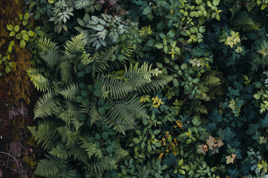
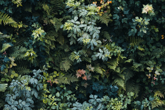
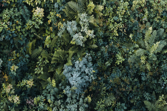
#photograph#photography#aerial photography#nature#fern#ferns#farn#farne#natur#beautiful nature#green#forest#wood#woods#woodlands#plant#plants
9K notes
·
View notes
Text

Tokyo, Japan 🇯🇵
#tokyo#japan#japanese#traffic#big city nights#big city dreams#big cities#big city life#august#summer#nightlife#city life#citas#cityscape#city#skyline#aerial#aerial shot#photograph#photography#toya's tales#style#toyastales#toyas tales#art
518 notes
·
View notes
Text
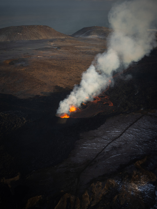


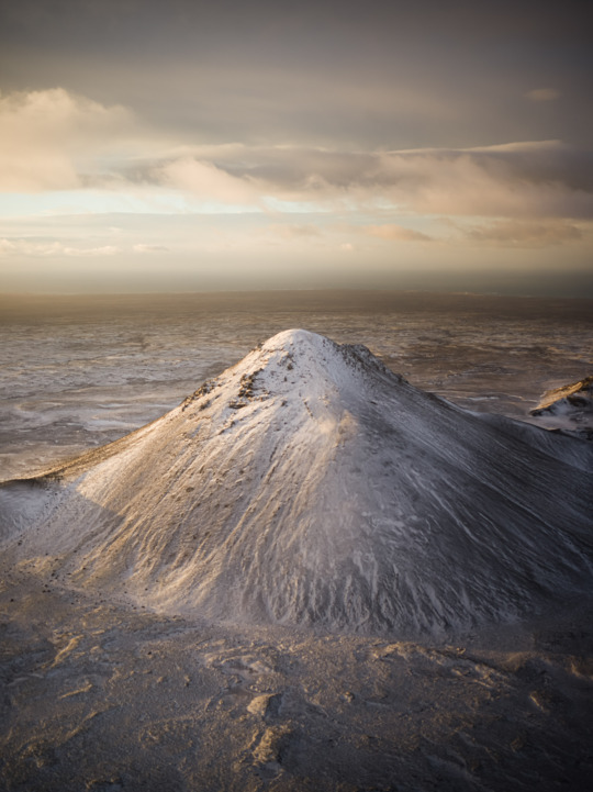
Reykjanes eruption, Iceland March 2024
Photographed by Freddie Ardley
#photographers on tumblr#landscape#photography#artists on tumblr#travel#nature#art#photographer#volcano#eruption#iceland#ice#mountains#lava#helicopter#aerial#winter
556 notes
·
View notes
Text

INSIDE_RS II
Mina, Nuevo León, México
Sierra Madre Oriental
#photographers on tumblr#landscape#artists on tumblr#mexico#original photographers#geology#lensblr#art#nature#mountains#aerial photography#sierra madre oriental#nydialilian#sierra#pink pale#gray
286 notes
·
View notes
Text

Nevada, USA
#photography#places#lensblr#photographers on tumblr#photo#travel#wanderlust#travel photography#nevada#usa#america#nv24#2024#nature#desert#scenery#landscape#aerial photography
203 notes
·
View notes
Text
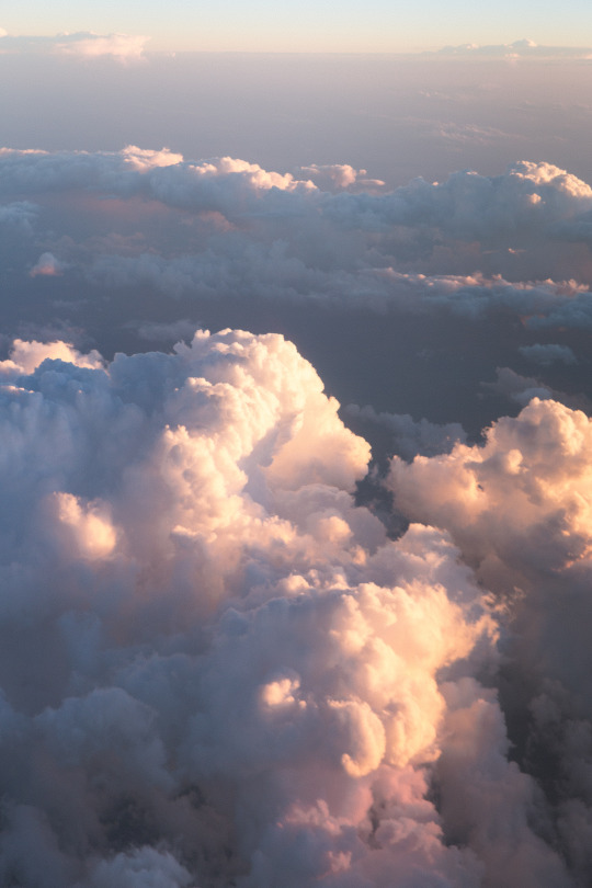
Closest thing I've felt to whole // Instagram / Website
#landscape#travel#photography#original photographers#nature#original photography#lensblr#photographers on tumblr#vertical#clouds#sunset#aerial
664 notes
·
View notes
Text

Kyrkesund Photo: David Altrath
#35mm#film photography#photography#35mm film#kodak#analog photography#photographer#photooftheday#film stills#architecture#building#wes anderson#atmosphere#travel#film frames#frame#filmisnotdead#cinematic#buildings#colorful#kodak film#landscape#north sea#sunset#clouds#west coast#sweden#drone photography#aerial#red house
164 notes
·
View notes
Text
About the entanglement of "science" and Empire. About geographic imaginaries. About how Empire appeals to and encourages children to participate in these scripts.
Was checking out this recent thing, from scavengedluxury's beloved series of posts looking at the archive of the Budapest Municipal Photography Company.
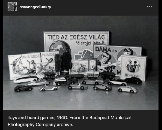
The caption reads: "Toys and board games, 1940."
And I think the text on the game-box in the back says something like "the whole world is yours", maybe?
(The use of appeals to science/progress in imperial narratives probably already well-known to many, especially for those familiar with Victorian era, Edwardian era, Gilded Age, early twentieth century, etc., in US and Europe.)
And was struck, because I had also recently gone looking through nemfrog's posts about the often-strange imagery of children's material in late nineteenth- and early twentieth-century US/Europe. And was disturbed/intrigued by this thing:
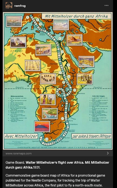
Caption here reads: "Game Board. Walter Mittelholzer's flight over Africa. [...] 1931. Commemorative game board map of Africa for a promotional game published for the N*stle Company, for tracking the trip of Walter Mittelholzer across Africa, the first pilot to fly a north-south route."
Hmm.
"Africa is for your consumption and pleasure! A special game celebrating German achievement, brought to you by the N*stle Company!"
1930s-era German national aspirations in Africa. A company which, in the preceding decade, had shifted focus to expand its cacao production (which would be dependent on tropical plantations). Adventure, excitement, knowledge, science, engineering prowess, etc. For kids!
Another, from a couple decades earlier, this time British.
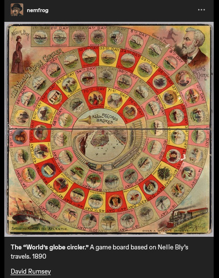
Caption reads: "The "World's globe circler." A game board based on Nellie Bly's travels. 1890." At center, a trumpet, and a proclamation: "ALL RECORDS BROKEN".
Same year that the United States "closed the frontier" and conquered "the Wild West" (the massacre at Wounded Knee happened in December 1890). A couple years later, the US annexed Hawai'i; by decade's end, the US military was in both Cuba and the Philippines. The Scramble for Africa was taking place. At the time, Britain especially already had a culture of "travel writing" or "travel fiction" or whatever we want to call it, wherein domestic residents of the metropole back home could read about travel, tourism, expeditions, adventures, etc. on the peripheries of the Empire. Concurrent with the advent of popular novels, magazines, mass-market print media, etc. Intrepid explorers rescuing Indigenous peoples from their own backwardness. Many tales of exotic allure set in South Asia. Heroic white hunters taking down scary tigers. Elegant Englishwomen sipping tea in the shade of an umbrella, giggling at the elephants, the local customs, the strange sights. Orientalism, tropicality, othering.
I'd lately been looking at a lot of work on race/racism and imperative-of-empire in British scientific and pop-sci literature, especially involving South and Southeast Asia. (From scholars like Varun Sharma, Rohan Deb Roy, Ezra Rashkow, Jonathan Saha, Pratik Chakrabarti.) But I'd also lately been looking at Mashid Mayar's work, which I think closely suits this kinda thing with the board games. Some of her publications:
"From Tools to Toys: American Dissected Maps and Geographic Knowledge at the Turn of the Twentieth Century". In: Knowledge Landscapes North America, edited by Kloeckner et al., 2016.
"What on Earth! Slated Globes, School Geography and Imperial Pedagogy". European Journal of American Studies 16, number 3, Summer 2020.
Citizens and Rulers of the World: The American Child and the Cartographic Pedagogies of Empire, 2022.
Discussing her book, Mayar was interviewed by LA Review of Books in 2022. She says:
[Quote.] Growing up at the turn of the 20th century, for many American children, also meant learning to view the world through the lens of "home geography." [...] [T]hey inevitably responded to the transnational whims of an empire that had stretched its dominion across the globe [recent forays into Panama, Cuba, Hawai'i, the Philippines] [...]. [W]hite, well-to-do, literate American children [...] learned how to identify and imagine “homes” on the map of the world. [...] [T]he cognitive maps children developed, to which we have access through the scant archival records they left behind (i.e., geographical puzzles they designed and printed in juvenile periodicals) [...] mixed nativism and the logic of colonization with playful, appropriative scalar confusion, and an intimate, often unquestioned sense of belonging to the global expanse of an empire [...]. Dissected maps - that is, maps mounted on cardboard or wood and then cut into smaller pieces that children were to put back together - are a generative example of the ways imperial pedagogy [...] found its place outside formal education, in children's lives outside the classroom. [...] [W]ell before having been adopted as playthings in the United States, dissected maps had been designed to entertain and teach the children of King George III about the global spatial affairs of the British Empire. […] [J]uvenile periodicals of the time printed child-made geographical puzzles [...]. [I]t was their assumption that "(un)charted," non-American spaces (both inside and outside the national borders) sought legibility as potential homes, [...] and that, if they did not do so, they were bound to recede into ruin/"savagery," meaning that it would become the colonizers' responsibility/burden to "restore" them [...]. [E]mpires learn from and owe to childhood in their attempts at survival and growth over generations [...]. [These] "multigenerational power constellations" [...] survived, by making accessible pedagogical scripts that children of the white and wealthy could learn from and appropriate as times changed [...]. [End quote.] Source: Words of Mashid Mayar, as transcribed in an interviewed conducted and published by M. Buna. "Children's Maps of the American Empire: A Conversation with Mashid Mayar". LA Review of Books. 11 July 2022.
Some other stuff I was recently looking at, specifically about European (especially German) geographic imaginaries of globe-as-playground:
The Play World: Toys, Texts, and the Transatlantic German Childhood (Patricia Anne Simpson, 2020) /// "19th-Century Board Game Offers a Tour of the German Colonies" (Sarah Zabrodski, 2016) /// Advertising Empire: Race and Visual Culture in Imperial Germany (David Ciarlo, 2011) /// Learning Empire: Globalization and the German Quest for World Status, 1875-1919 (Erik Grimmer-Solem, 2019) /// “Ruling Africa: Science as Sovereignty in the German Colonial Empire and Its Aftermath” (Andrew Zimmerman. In: German Colonialism in a Global Age, 2014) /// "Exotic Education: Writing Empire for German Boys and Girls, 1884-1914". (Jeffrey Bowersox. In: German Colonialism and National Identity, 2017) /// Raising Germans in the Age of Empire: Youth and Colonial Culture, 1871-1914 (Jeff Bowersox, 2013) /// "[Translation:] (Educating Modernism: A Trade-Specific Portrait of the German Toy Industry in the Developing Mass-Market Society)" (Heike Hoffmann, PhD dissertation, Tubingen, 2000) /// Home and Harem: Nature, Gender, Empire, and the Cultures of Travel (Inderpal Grewal, 1996) /// "'Le rix d'Indochine' at the French Table: Representation of Food, Race and the Vietnamese in a Colonial-Era Board Game" (Elizabeth Collins, 2021) /// "The Beast in a Box: Playing with Empire in Early Nineteenth-Century Britain" (Romita Ray, 2006) /// Playing Oppression: The Legacy of Conquest and Empire in Colonialist Board Games (Mary Flanagan and Mikael Jakobsson, 2023)
#mashid mayar book is useful also the Playing Oppression book is open access online if you want#in her article on slated globes mayar also mentions how european maps by 1890s provoked a sort of replete homogenous filling in of globe#where european metropole thought of itself as having sufficiently mapped the planet by now knit into neat web of interimperial trade#and so european apparent knowledge of globe provided apparently enlightened position of educating or subjugating the masses#whereas US at time was more interested in remapping at their discretion#a thing which relates to what we were talking about in posts earlier today where elizabeth deloughrey describes twentieth century US#and its aerial photographic and satellite perspectives especially of Oceania and Pacific as if it now understood the totality of the planet#ecologies#tidalectics#geographic imaginaries#mashid mayar
134 notes
·
View notes
Text

Gold Island on the Kootenay River
An aerial view reveals a small, lush island surrounded by calm, blue-green water. Tall trees cast long shadows across the island, highlighting the varied foliage
#island#aerial view#trees#shadows#water#greenery#calm#landscape#nature#lake#drone#drone photograph#drone photography#aerial photograph#aerial photography
0 notes
Text

Clouds over Greenland
244 notes
·
View notes
Text
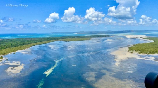
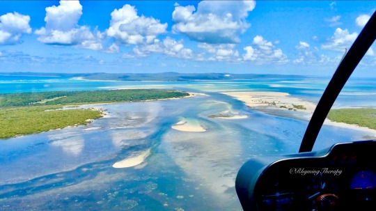


(i like to imagine) air & sea
as mirrors of cosmic symmetry
in energetic excitation states
of turbulence & tide
sand emerging from the ocean
in superfluid patterns
mimicking the fractal nature
of cloud formations
their architecture evolving
in transcendental
tandem—both above
and below the horizon
the uncertainty of wave function
proposing entanglement
of many-bodies
inside the spatial temporality of time
.
RhymingTherapy—December 2024 (screenshots from a video taken by me during a helicopter flight around Moreton Island in Queensland, Australia).
#writerscreed#poeticstories#twcpoetry#poets on tumblr#photographers on tumblr#original photography#nature#sky#ocean#Moreton Island#australia#water#clouds#islands#aerial photography#beautiful#scenery#views#poetry#writers on tumblr#the uncertainty principle#cosmic symmetry
122 notes
·
View notes